Category Archives: Arable

Fit for purpose accuracy

SBAS GPS for Horticultural Farm Management

This project investigated potential improvements in GNSS positioning accuracy using satellite based augmentation (SBAS) in various farming environments in NZ.

Put simply, SBAS is a system with a network of known land-based control points that provides correction signals to GPS units via satellite. The US equivalent is WAAS, the European equivalent is EGNOS.

The project focused on testing the SBAS Technology, comparing it with commercial systems currently available (at different levels of accuracy). Through insights gained from growers, the economic benefit SBAS could bring were assessed.

Vegetable growers view RTK-GPS as the Gold Standard and use it where precise positioning has value. Uncorrected signals are suitable for some applications but sub-metre is preferred. Handheld devices are often tried and generally rejected after disappointment, losing potential benefits of better management if better location data were available.
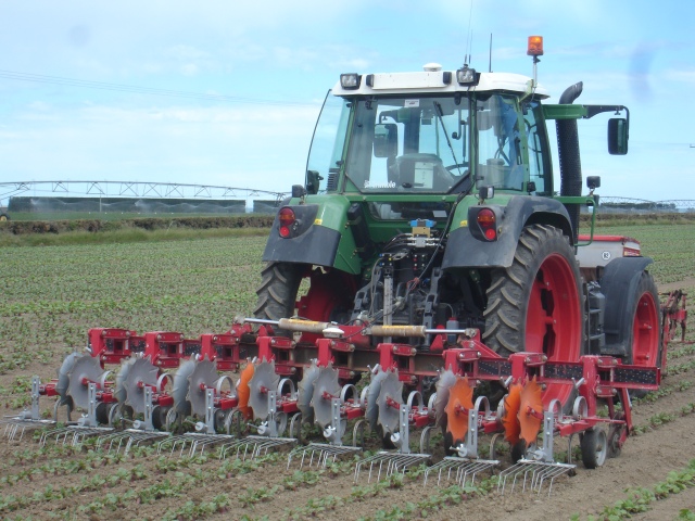
High accuracy RTK-GPS on both tractor and implement keeps weeders in correct position

Apple growers appear slower to adopt GPS technologies because they identify a gap between very expensive and unwarranted RTK-GPS and cheap inadequate alternatives.  Part of the reason is trouble getting good signals when working in large trees. The SBAS technology offers fit-for-purpose guidance and logging that could change the way growers use positioning technologies to enhance management and profitability.

Using several alternatives, we tested SBAS technology for both static point location and kinematic guidance. Static location is beneficial for recording points of interest such as diseased plants, weeds and harvest bin location. Kinematic guidance allows growers to track operations such as spraying, ensuring no missed or double ups.

We tested a few systems at the MicroFarm. Black and yellow rings are RTK-GPS points, blue and white lines are runs using our Arrow100 with SBAS , green line is a Bad Elf with SBAS and the yellow line a smartphone GPS. Lots of trails: what do you see in these?
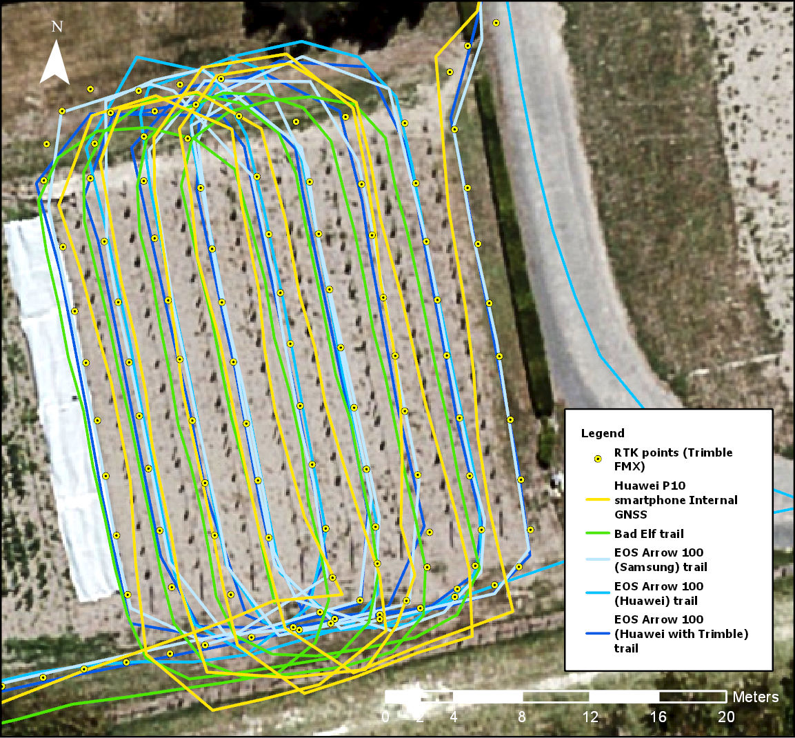
Yellow dots = RTK GPS
Blue lines= EOS Arrow 100 SBAS
Green line = BadELF SBAS
Yellow line = Smartphone GPS

The project is one of a number funded under a joint Australia/New Zealand government initiative through the Australian CRC for Spatial Information and LINZ.

This project was completed on behalf of LandWISE Inc.

Contributing partners:
Page Bloomer Associates Ltd
GPS Control Systems Ltd
Hectre Group Ltd


Excessive surface ponding

I’ve worked a lot and with many people on irrigation efficiency and on application of effluent to land. We keep coming up against the question, “What actually constitutes surface ponding?”

I’d love to get some agreement on this.

In the last year or so:

  • I’ve heard that ponding only applies to durations lasting 4 hours or more, and I’ve heard it applies to anything from a few minutes duration.
  • I’ve heard it has to be at least a pretty big area and I’ve heard anything at all counts.
  • I’ve been told the Environment Court determined any duration mattered. A regional council had applied a four hour minimum when assessing ponding, but the court said the consent said ‘no surface ponding’ and that meant no surface ponding.
  • I’ve seen lots of it and I’ve seen evidence that excessive application rates are problematic – both for irrigation and for land applied effluent.

There will almost always be some surface ponding; even drip systems micro-pond. So applying a concept of excessive surface ponding seems better. But what is excessive surface ponding?

Excessive surface ponding – defined

In the interests of sparking debate, I propose a definition of excessive surface ponding:

“Excessive surface ponding means the presence of surface water pooled in contiguous areas of greater than 0.04m2 found, one hour after application starts,  at more than four of forty sample points selected at random over at least 25% of the application area, with each point being more than two metres apart.”

  • Surface water pooled may need definition, but I’d say means clearly visible puddling – i.e. not just wet soil
  • contiguous areas means connected
  • 0.04m2 (about 20x20cm) is bigger than a hoof print (my first intent) but is maybe too small – the auction starts now, your bids please . . .  .
  • one hour after the start of application covers both travellers and stationary nozzles but is the time right?
  • Four of forty sample points means 10% and hopefully is a big enough sample that is not too onerous to take
  • Random is random – let’s specify a method e.g. tossing a 0.25 m2 quadrat or ring backwards over your head with your eyes shut having spun twice clockwise
  • 25% of the application area means you have to look around a bit
  • More than 2 m apart spreads it out a bit and avoids sampling landing in the same contiguous, but relatively small, pond. Pick a number (and justify it!)

I don’t know that I agree with my proposed definition.

For a start, I’ve watched high application rate water (and effluent too) disappear very rapidly, and upon digging significant holes, couldn’t find sign of it in the rootzone. So maybe, if you can’t see ponding for more than 10 minutes, that’s when you should get worried!?

Please, have a think, then post a comment below. Let’s try to have a reasoned and enlightening debate!

Regards

Dan