Case Study
This is an example where analysis showed that almost no land-shaping was required to address losses from significant ponding. The initial state is shown below. The onion crop suffered significant losses and access was restricted due to persistent wetness. The wheel ruts are sprayer runs. The furrows were effectively sealed so water could not escape.
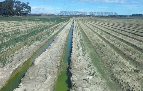
Deep wheel ruts and large areas of crop loss resulting from surface ponding
The beds are perpendicular to the natural direction of flow. The land slopes from left to right in the above picture, but the raised beds act as dams and hold the water in the furrows.
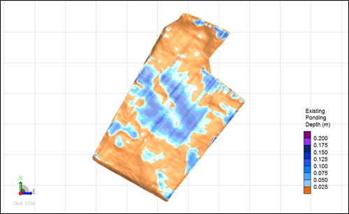
Surface Ponding across Block with beds running perpendicular to the direction of land slope
This block was surveyed by tractor using RTK-GPS. The crop was still present so the survey was up and down the beds. The bed direction is visible in the image.
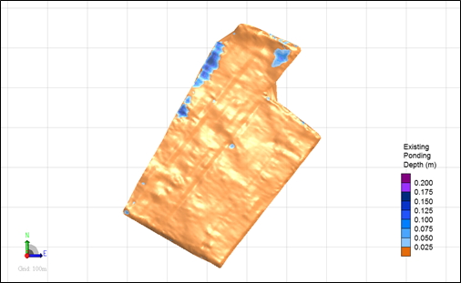
Surface Ponding across Block with beds running with the direction of land slope
The second image shows most of the ponding has been removed, merely by changing row direction. Because the survey included beds present at the time, they still show up in the second image. If we were to engage in land shaping, a new survey and analysis would be made after the field had been cultivated to remove compaction, ruts and beds.
The table below compares the area and depth of surface ponding of the two scenarios.
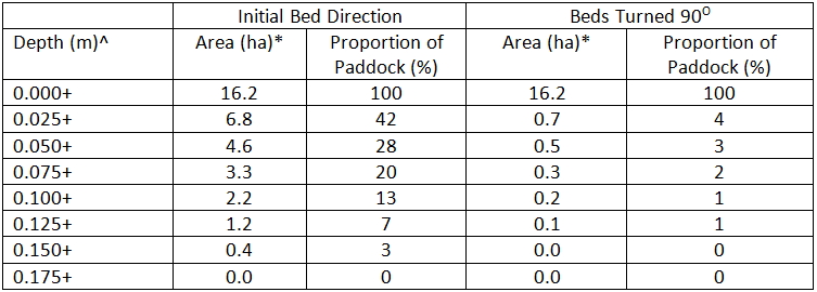
A comparison of the area and depth of surface ponding with initial cross slope bed direction and beds turned 90 degrees to run downhill
A soon as this crop was removed, the farmer cultivated to remove compaction and old beds, and re-established the beds running down the slope. A very minor amount of shaping removed the remaining ponding area.
Land levelling options
Land levelling could to be used to solve the ponding problem.
Leaving the beds running across the slope would require a significant amount of soil movement as shown below. This equates to 2,200m3 of cut or 137m3 cut per hectare.
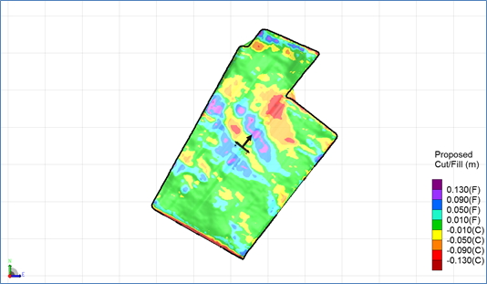
Map of Cut and Fill required to effect good drainage while running beds across the slope
The amount of levelling required if beds are run down the slope is massively reduced. Indeed only 180m3 of cut or 11m3/ha of cut is needed – a saving of 2,000m3.
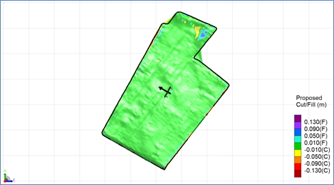
Map of cut and fill required to effect good drainage while running beds down the slope
